Bicycling San Pedro Town: 22 clicks to home

Bear with me here.
We’re going to try something new, and I’m afraid a bit amateurish.
I want to try to recreate the experience of traveling around Ambergris Caye on a bicycle, to give readers a more-accurate sense of what life is like here — the traffic, the chaos, the odd sights, the sweet shots, etc.
You know, life on a Caribbean island as seen through the eyes of a newly landed American ex-pat riding a Taiwanese bicycle and shooting pictures with a China-made iPhone.
I know what you are thinking: Really? Shooting pictures with an iPhone? Where is your GoPro Hero 3+ camera?
Answer: Very much a figment of my imagination and beyond the reach of my wallet. And the battered but once-trusty Olympus FE-340 that I brought with me is now a salt-encrusted paperweight. Island life is rough on personal tech items … and cotton T-shirts, among other things.
OK, let’s get back on point.
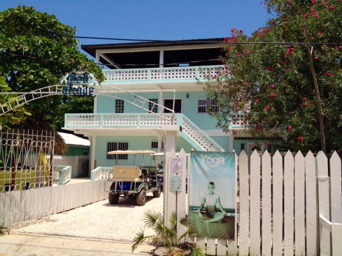
Last week, after yoga at Zen Arcade, I slowly bicycled home, left hand steering and right hand clicking off photos until I reached my destination. I don’t know if these 22 photos will reveal anything interesting about this ride, this town or this island. We shall see. I’m adding maps to give a sense of where I am in any given image.
This isn’t a terribly long ride. I can get from the yoga studio to home in 12 minutes if I’m in a hurry. Which I never am.
This much I’ve learned: The journey always seems longer when you are a stranger in a strange land. When I ride through town I am in a perpetual state of discovery — new shops, new people, new vehicles, new tourists, new opportunities, new traffic flows. I may only be cycling a couple of miles but if you figure in head-swiveling and information processing, the ride feels more like 10.
But a fun 10 miles at that.
OK, the basics: We live just north of the Sir Barry Bowen Bridge in a complex called Barrier Reef Resort (or something, the name changes with each fresh coat of paint and lawsuit). The Zen Arcade studio is just over two miles south of us, below the center of town, near the Bowen & Bowen beverages warehouse and the airport runway. This trip heads south to north around 12:15 p.m. on a Friday.
And yes, the name Bowen is as ubiquitous to Belize as Nickerson is to Cape Cod.
What I find most surprising is how incredibly empty the streets are on this Friday at lunchtime. I didn’t even notice until I started uploading the photos. I mean, it is lunchtime. Usually shops are closed and everyone is out trying to score stewed chicken, rice and beans in Styrofoam containers from the dozens of local delis.
Can’t explain it. Just nobody — hardly anybody — out and about.
Maybe they heard the crazy guy on a bicycle with an iPhone — who thinks he’s a Google maps photographer — is headed their way ….
So here we go. I’d recommend cranking up a Jimmy Buffett, Bruce Springsteen or Van Morrison soundtrack while reading through this.
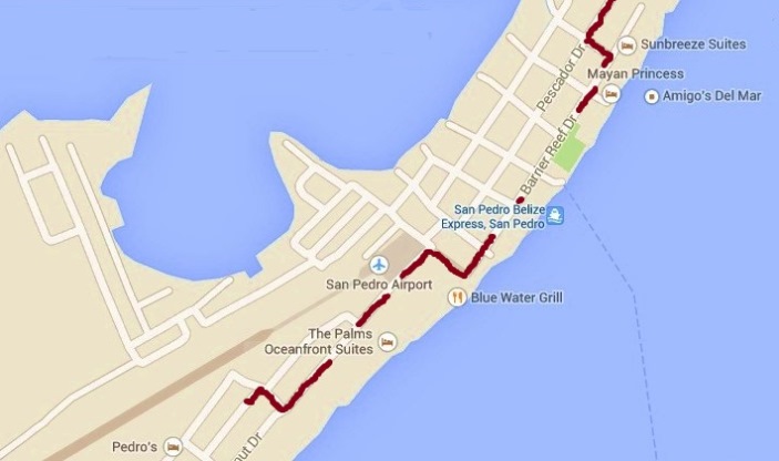
First of three maps: The red line starts at Zen Arcade. Head north for 30 yards then east for another 30 yards, between Island Supermarket and Bowen the Belikin distributor. At the intersection we turn north again. On your far right is Island Academy,then the Bowen Family home and Ramon’s Village, a big resort. On the left, midway down this straightaway, is Coconut Cafe. This is Coconut Drive. It ends at the entrance to the airport where we take a sharp right down a sandy alley that drops us off at the start of Barrier Reef Drive (once called Front Street).
*** *** ***
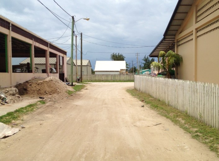
This is the small bit of road from Zen Arcade to the Belikin beer warehouse on the right. On the left is a golf cart rental place where much very loud work — not apparent to the human eye — is being done at the moment . Take a right t the end of the fence.
*** *** ***
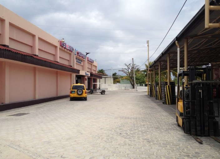
There you go, Island Supermarket on the left, Bowen & Bowen warehouse on the right. The T-intersection at the end is often jammed with two-way traffic. But not this day. White picket fence to the right begins property of the idyllic Island Academy. But we’re turning left …
*** *** ***
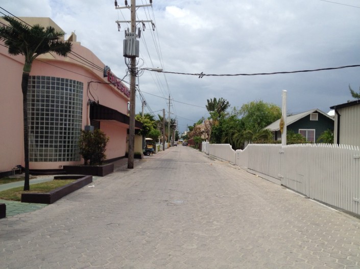
Welcome to Coconut Drive. More of Island Market on the left and a bank. Just beyond the pink building is Wine de Vine, very nice place to spend happy hour on Fridays. Beyond the picket fence to the right begins Ramon’s Village, some of which burned down in a fire last August but has already been rebuilt.
*** *** ***
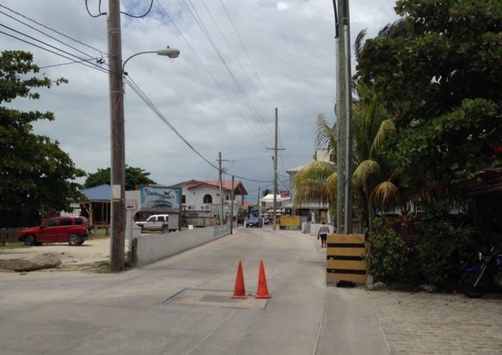
Coconut Drive continues past Ramon’s. On the left behind the white picket fence is Carlo & Ernie’s Runway Bar. Just beyond the trees is the actual runway. Much fun to sit, sip beer and watch the little planes land on windy days. The pilots are very good. In the next building is mail Boxes Etc. where we get our mail on Thursdays. Comes once a week from Miami. What? And you are worried about losing Saturday delivery? Once a week works for us.
Those two cones, by the way, have been there for a couple of weeks. between them is a hole that drops hell knows how deep into the sewer system.
*** *** ***
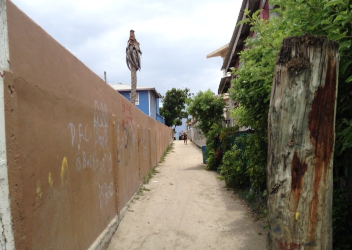
At the end of Coconut Drive we take a sharp right int this alley. It avoids the sometimes hectic traffic in front of the airport and around the Catholic elementary school, which is behind the wall on the left. Caribbean Sea is directly ahead.
*** *** ***
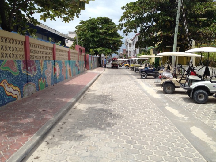
A left at the end of the alley takes us to the start of Barrier Reef Drive, the road closest to the beach and, of course, the most touristy. The Catholic grade school is to the left. To the right is the town library and above it, the Belize Tourism Authority. Beyond the tree, the road is one-way heading north.
*** *** ***
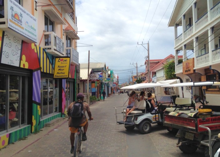
We’ll be on Barrier Reef drive for a bit so, watch your step. As you can see, the driver of the golf cart backing out isn’t looking behind her, and the bicyclist isn’t about to give way. This is very natural driving form here. Nobody looks where they are going and nobody stops for nobody. People aren’t rude. They just have a lot of faith in each other. I think.
*** *** ***
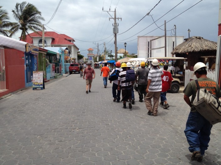
Continuing north on Barrier Reef, traffic picks up. Got no idea what the hard-hat crew was all about. Looks like they might have just got off the Belize Express taxi boat. Beyond them to the right is Central Park, very much the town center for public events. It is bordered by a long row of tables filled with art, crafts, jewelry and other memorabilia. To the right of the clock tower in the middle of the road is the Catholic Church. Another couple of blocks beyond the tower and we take a left for one block. A good place to add the second map.
*** *** ***
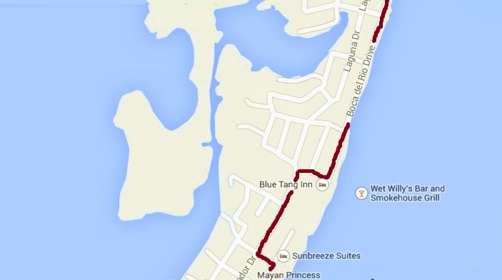
Map 2 of 3: This takes us from Barrier Reef Drive up to Pescador and then over to my favorite road on the island, Boca del Rio Drive, which is a throwback to the days when all the roads were hard-packed sand. You’ll see why it is a favorite when we get to it.
*** *** ***
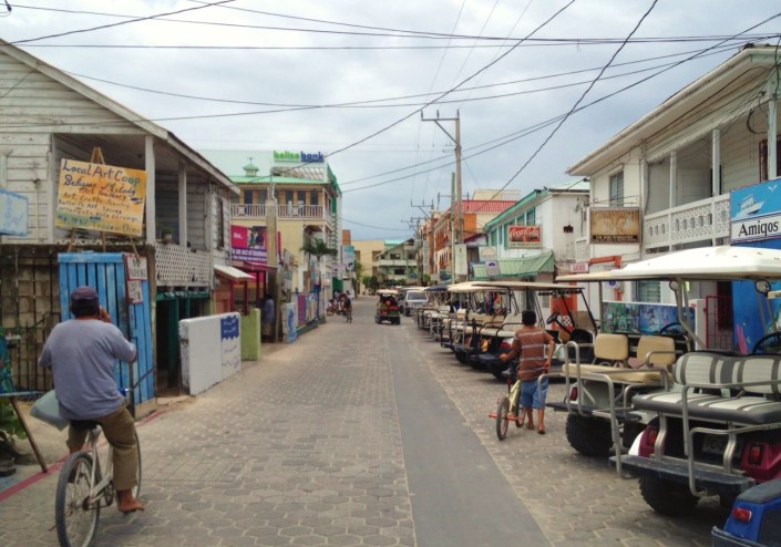
Barrier Reef Drive (below) dead ends up ahead, and unless you want to do the walk of shame through the Phoenix Resort’s lobby, you’d better take a left on Caribena Street just before the Belize Bank building.
*** *** ***
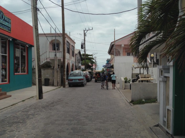
This one block of Caribena Street is worth noting only because it contains the Man O War store. It offers men’s casual clothes, toiletries and sporting goods.That’s all. I think. But the name — so rich in testosterone, you just hope there is more behind the facade.
*** *** ***
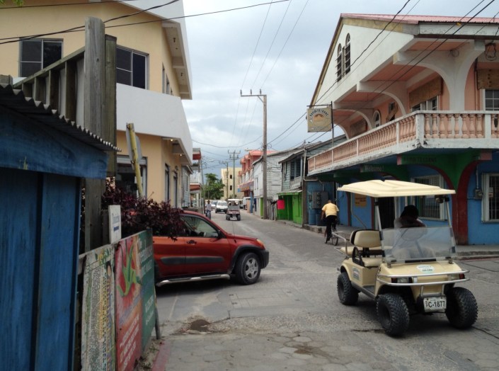
This is the intersection of Pescador and Caribena, facing north. On the left is a computer store where they say they can fill your every tech need. Just beyond it is the police station, fire station, power company and phone company. This is a two way street from here north, and one way south following the golf cart on the right. If it looks like the cars ahead are aiming right at each other, they probably are. New rule: a street is only two way if there is no immediate oncoming traffic. Otherwise, you take the middle of the road. Keeps it interesting.
*** *** ***
Your eyes do not deceive you, that is indeed a traffic circle with a statue in the middle. Just to the left is Costillo’s Hardware, may island favorite of the dozen or so hardware stores. If we go around the circle and take the first right we end up on Laguna Drive, currently much under construction. We’ll veer to the right in front of Cay Mart and take a short road to Boca del Rio Drive aka “the beach route.”
*** *** ***
Just a short two blocks to the beach and Boca del Rio Drive. This road was once a lumpy, potholed mess. Vastly improved in the three months since we arrived here. Thank you, San Pedro Town Council.
*** *** ***
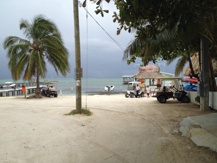
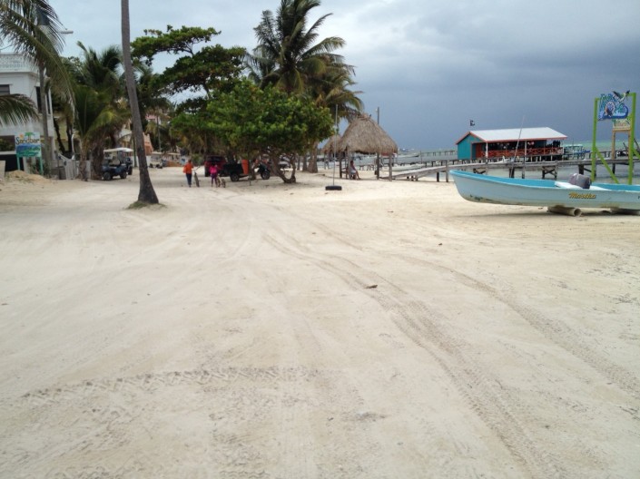
A left around this telephone pole and we are on the hard sand Boca del Rio Drive. Straight ahead at the end of the pier is Wet Willy’s. Jerry Jeff Walker comes to play there every year, while kicking back at his home south of town on Mosquito Coast. To the right is the Blue Tang Hotel, first place we ever stayed on the island.
*** *** ***
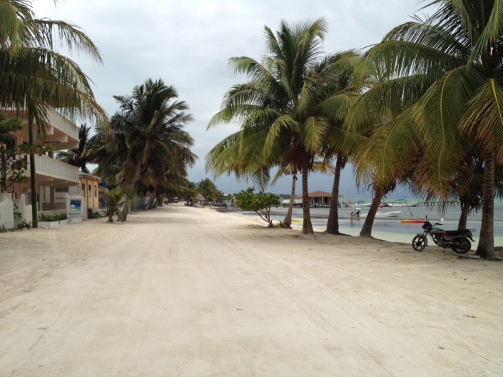
You can see why this leg of the ride is like a nice reward for navigating all the paved roads. The San Pedro High School is along this road, as are many small resorts. It ends at a town park with a basketball court.
*** *** ***
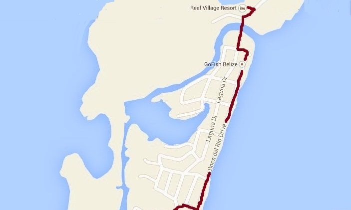
Map 3 of 3: Last leg of the trip home. At the end of Boca Del Rio, we’ll zig left, then zag right onto Laguna Drive right in front of the Sir Barry Bowen Bridge. There is a toll for motorized vehicles. Bikes ride free. Yea, bikes!
*** *** ***
A little more of Boca del Rio Drive.
*** *** ***
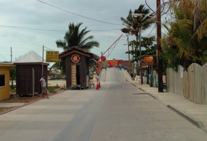
Toll booth just before the bridge. A nice older gentleman is out here every day sweeping the bridge with a broom. His name is Fred. We make a point of saying hi to Fred whenever we pass him and just wish him a nice day. He smiles and waves, which none of the toll takers ever do.
*** *** ***
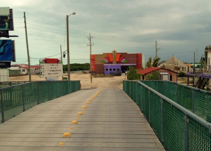
Breathtaking view from the top of the bridge, the highest elevation in town! Kidding about the breathtaking part. That’s Paradise Theater straight ahead. Sign at left tells you what movies will be playing this weekend in the duo-plex cinema. It is also used as a Christian church on Sundays. We’ll veer to the right once over the bridge.
*** *** ***
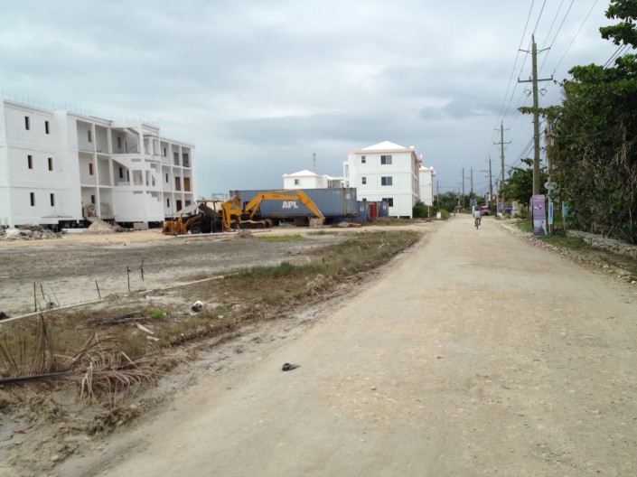
Just up ahead on the left is home, the Barrier Reef Resort. most of the time these days this section of road is underwater, a combination of high tide, low land and rain. The city has announced plans to pave the road from the bridge to a major resort three miles up the road.
*** *** ***
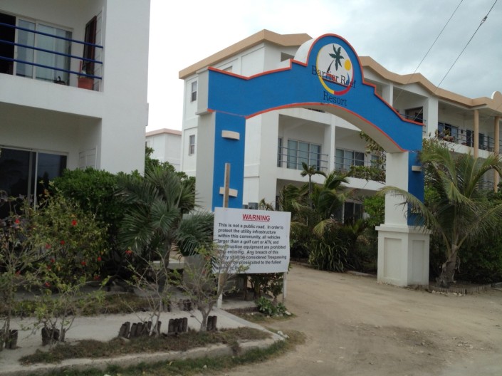
Through the archway, and we’re home.
*** *** ***
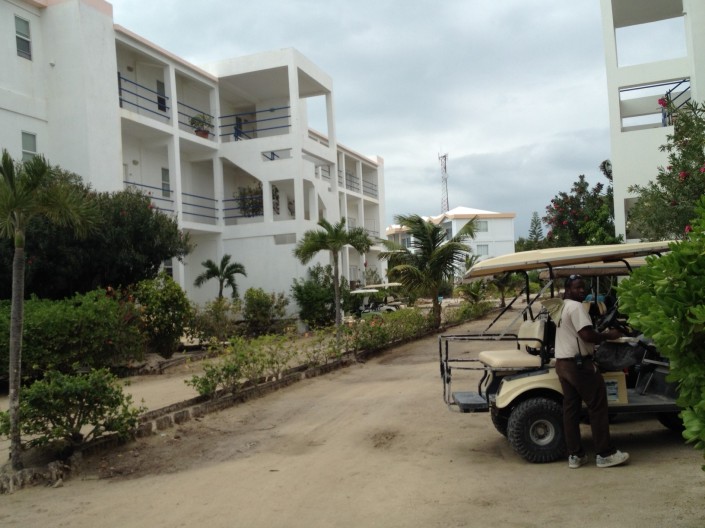
Around the corner and that’s our building on the left. For the first month we lived here I carried both our bikes up to the third floor and locked them to the railing. Then I noticed that two bikes have been sitting in the ground floor rack unlocked since at least the day we arrived. They’re still there parked next to two locked ones. To the right is one of our security guys, nicest security guys on the island, which may explain why the bikes are safe.
That’s it. I must say, if you read this whole thing it took you longer than it takes me to ride home. And I feel bad that the streets were so empty. Honestly, most of the time they are filled with pedestrians, bicyclists, golf carts, taxis, delivery trucks and stray dogs.
I hope this wasn’t too tedious. If I do it again, I promise to stay more focused and concise.
Your turn to vote:
A. Bob, how about just a block or two at a time?
B. Holy crap, Bob, how much do you think we can take? No more!
C. Look Boob, it was helpful. maybe do it again in a month or so.
D. Bob? Your name is Bob?
Tabulators are standing by.
Thank you for your service.
And patience.


May 21, 2014 at 9:31 pm
I loved it, even though I read it while listening to Beck’s sad new album. I will choose something cheerier for your next photo bike tour. 🙂
LikeLike
May 21, 2014 at 9:39 pm
Beck? Oh, no. OK, next time I’ll take slower, sadder pictures and you can play Beck!
LikeLike
May 21, 2014 at 10:02 pm
I loved it! So glad you took the time to do this! We are coming down in August for a visit to see if this is the place for us to retire but between you and Tacogirl’s blogs I feel like we already know the answer. Love your blog and look forward to reading more and more. Hope we get another tour soon!
LikeLike
May 22, 2014 at 6:19 am
Susan, good for you! Check it out. I’d also recommend blogs San Pedro Scoop from Rebecca Coutant and “Belize- Building a new life” from John East. Also, one of the best things I ever did was set up a Google news digest with the keyword “Belize.” A once-a-day summary of relevant trending stories — some that are pretty disturbing when it comes to Belize crime and violence. Keeps me grounded in reality.
LikeLike
May 22, 2014 at 6:47 am
Thanks, I will definitely check these out and I do receive the SAN PEDRO SUN daily so I think I get the gory details along with the good. Heck, I’m just 40 miles outside of Philly so shootings, stabbings and robberies are a daily occurrence in these parts I’m sorry to say. But will absolutely take a look. Thanks again for such an interesting blog…keep up the good work!
LikeLike
May 22, 2014 at 5:13 am
Loved it, as we are moving in Sept, to Barrier Reef so it was just like you were showing us the town, the important places like the stor, hardware…etc…..cool…was funny that no one was out and about, never see that their!
LikeLike
May 22, 2014 at 6:28 am
Kathy, welcome to Barrier Reef! By the time you arrive we may actually have a paved road all the way into town! And seriously, it was like a Twilight Zone episode, “Last Man On a Deserted Island.”
LikeLike
May 22, 2014 at 5:39 am
Loved it but We need Ziggy to narrate and Grease the chain. – Thanks for the photos
LikeLike
May 22, 2014 at 6:13 am
Isn’t it amazing how rusted the chain is after three months? Shortly after I took this photo I cleaned the muck and rust off both our bikes, tightened the chains and sprayed them with a WD40 product designed especially for chains and gears. Big difference!
I agree — Ziggy would add panache. Better yet, a Ziggy Cam. Must propose this to John & Rose when Ziggy returns to the island. They miss him very much at the moment.
LikeLiked by 1 person
May 22, 2014 at 7:12 am
I loved it!!! Keep it up! I won’t need a map by the time I come there in September with all your great blogs!
LikeLike
May 22, 2014 at 5:10 pm
I loved it too! Thanks for the quick tour. 🙂 By the way, how many miles it it round trip?
LikeLike
May 22, 2014 at 7:14 pm
I’m guessing that round-trip would be under six miles. I am honestly having a terrible time with distance here. Everything “seems” far but really isn’t. The whole island is 24 miles long and less than a mile wide for the most part. The population is mostly bunched up in San Pedro.
LikeLike
May 22, 2014 at 5:21 pm
Robert, I’ve been addicted to your blogs for the past several months and have enjoyed all aspects of it. My wife and I will be staying at our condo at Belizean Shores the first week in June (only 12 days from now) and would love to meet you and Rose if possible during our stay, as our goal is to eventually move there permanently and could really use your input. Any chance of meeting you for breakfast or lunch or Happy Hour during that week? My treat, since you’ve provided us with hours of Ambrigris living while living in the Pacific NW (former SoCal refugees). Rob
LikeLike
May 22, 2014 at 7:08 pm
Thank you, Robert. I really appreciate the support. I’m not sure how helpful we can be as we’re pretty new at this ourselves. Rose begins teaching Pilates the first week in June so I’ll need to double-check her schedule.
Why not contact me at robertj.hawkins2012@gmail.com and let’s find a time to get together!
LikeLike
May 24, 2014 at 11:39 am
Keep writing Robert……..it’s all amazing to me and your photos are fantastic. I still review the chest high photos from your walk in a previous post. You should get a nomination on just that diary log alone. Very vivid and nice of you to share. The Drone clips are absolutely eye catching. I think that technology will take us places we could never have imagined.
Don
LikeLike
May 28, 2014 at 6:15 pm
It’s fun to see all our old haunts and a few changes as well (like the name of the complex where you live, for one!) When we were there, the Boca del Rio beach road was often in semi- to quite rough shape (lots of holes and such), so once the road south of the bridge, parallel to BdR, was paved, we almost always took that as we enjoyed scooting along quickly on our bikes. It was such a nice, smooth road compared to many on the island. Thanks for sharing your photos and commentary — always nice when the roads are “empty”, isn’t it?
LikeLike
May 28, 2014 at 9:02 pm
Hi Emily, So, the town now plans to pave the road from Grand Caribe, south to the bridge over the next two months. Trade off is fewer potholes and dust but more and faster traffic, I guess.
Lately, Boca del Rio has been the smoother of the two routes. The water company has been moving down the mail road digging up sections for some pipe work and rather roughly replacing the concrete squares. They’ve been smoothing them out over time but it is bicycle roulette — every day a different block is barricaded! But it is progress!
With a little paint we became Barrier Reef Resort, but in fairness, the new management has been making big improvements to the resort infrastructure, including real septic systems! Name change was probably warranted from what I’ve heard.
LikeLike